3 Avenue South Beautification Functional Planning - Stafford Drive to Mayor Magrath Drive
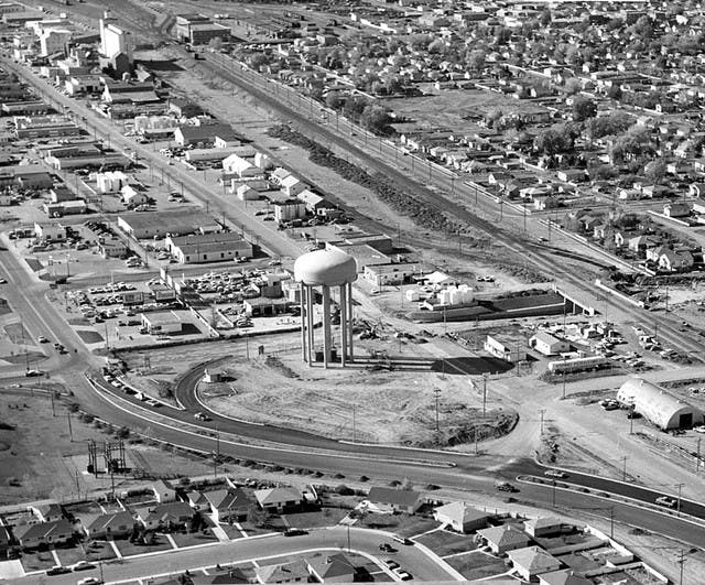
Prior to the construction of Highway 3 (Crowsnest Tr), 3 Ave S functioned as the major road through Lethbridge along Highway 3 east and west of the City limits. Since Highway 3 was reconstructed (mid 1980s), 3 Ave S has transitioned to a commercial corridor between Scenic Dr S and Mayor Magrath Dr S. Because of these years of change, the functional and visual characteristics along 3 Ave S vary significantly making it disconnected and at times, dysfunctional.
The 3 Ave S Beautification Project is a planning exercise that will take into consideration current businesses as well as existing planning documents such as: Transportation Master Plan, Heart of Our City Master Plan and Cycling Master Plan. Community engagement and feedback will be a critical part of this plan. We look forward to working with residents to create an exciting new vision for 3 Ave S. We are looking for feedback around how the corridor should function including traffic patterns, bike lanes, accesses, and parking is what we are looking for at this time from stakeholders.
To learn more about past engagement and the work that has been done for the functional planning study to date please take a look at the presentation boards from our most recent open house event. https://getinvolvedlethbridge.ca/12910/widgets/51852/documents/91222
-
Phase B Engagement Forum
Share Phase B Engagement Forum on Facebook Share Phase B Engagement Forum on X (formerly Twitter) Share Phase B Engagement Forum on Linkedin Email Phase B Engagement Forum link3rd Avenue is an important corridor that transitions in character between downtown and Mayor Magrath Drive. Through the 3rd Avenue Beautification project, we are exploring how to create a safe, friendly, vibrant, and appealing space for not just cars but also transit, pedestrians, and cyclists. See the above map for details on how the street has been divided into precincts to aid in reviewing the infrastructure and character needs of different areas of 3rd Avenue. While 3rd Avenue is still a thoroughfare, the goal is to also make it a place.
Through the first round of engagement, you told us in your own words what was most important to you in making 3rd Avenue the next great place in Lethbridge. These were the top themes that came out of your comments:
What We’ve Done
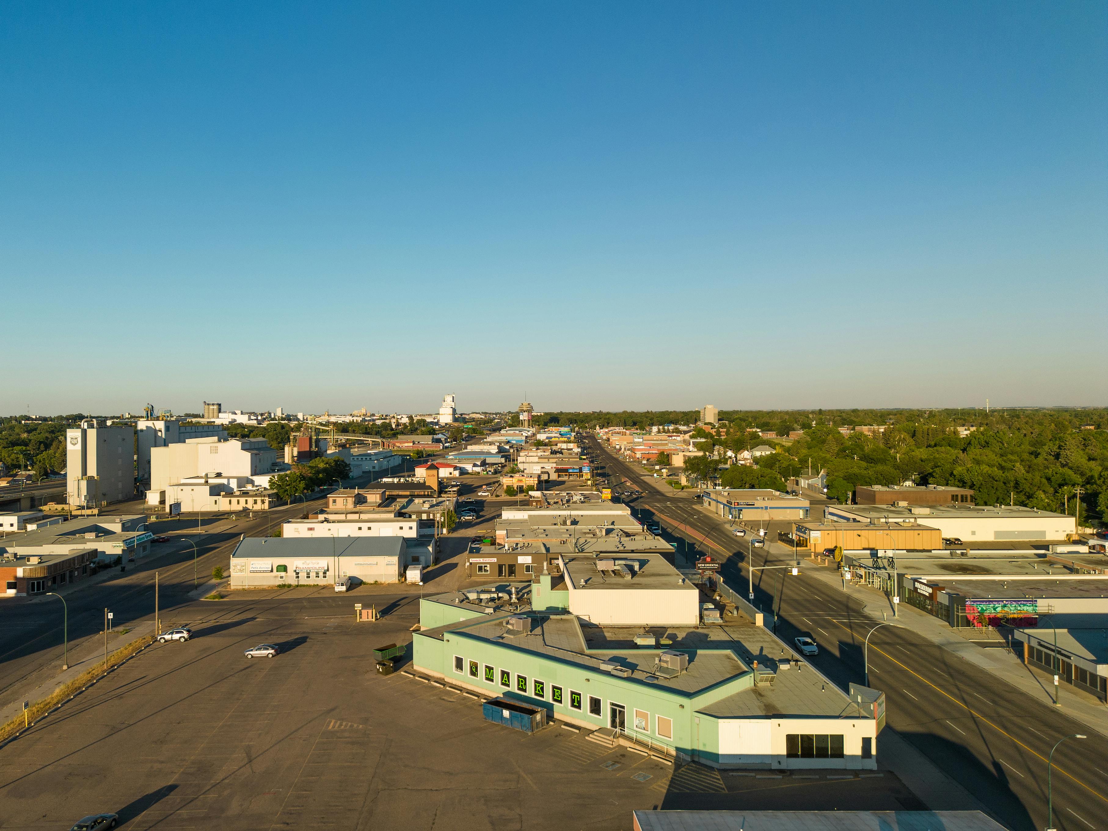
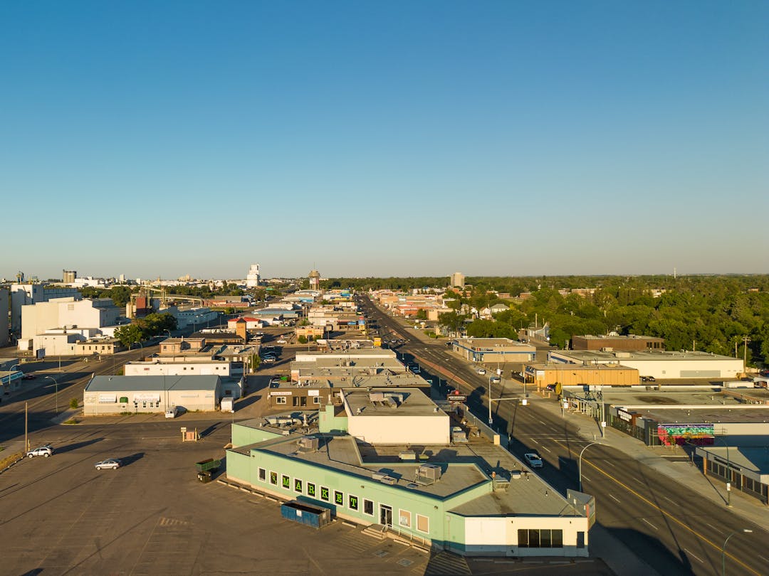
Our team of planners, designers, and engineers have thoughtfully taken these ideas and have used them to generate several options for what each precinct along the street could look like. Here is the example of what the East Business Precinct currently looks like, and several concepts of what the street could look like based on the themes previously identified.
For your reference, this is what 3rd Avenue South currently looks like in the area identified as the East Business Precinct. There are two lanes of traffic in each direction, a parking lane on each side of the street, and wide sidewalks. There are no bike lanes or bike facilities, and minimal greenery and pedestrian comforts such as seating and lighting.
This option prioritizes off street parking facilities for automobiles, protected bike lanes on both sides of the street, bike racks, greenery, and seating. The sidewalks are still wide, but there is one lane of traffic each direction, and no on street parking.
This option prioritizes the pedestrian environment, with space for patios and seating, greenery, and space for walking. There are protected bike lanes on both sides of the street, and parking on one side. There is one lane of traffic in each direction.
This option prioritizes the cycling and safety. There are bike lanes on both sides of the street that are separated from vehicles by treed boulevards and pedestrians by planter boxes. There is space for pedestrians to walk as well as sit on seating and at patios, though there is less space than the other options. There is one lane for parking, and a single lane in each direction for vehicular traffic.
Placemaking
Understandably, it can be difficult to visualize the potential for 3rd Avenue South through just these cross-sections. So, here is an example of a spaces along the street paired with a few examples of what these spaces could transform into as a result of this project.
3rd Avenue South and 17th Street South
The southbound section of 17th Street South at 3rd Avenue is a dead end street terminating at the sports fields for Victoria Park HS and Lethbridge Collegiate Institute. This section of street has been identified as a placemaking opportunity due to its proximity to the education institutes adjacent to the street and an active student body willing and able to improve the economic condition and vitality within the corridor. Design ideas could include: Safe well marked pedestrian links to the school sites, increased trees and vegetation, plaza space, food truck parking, public art and murals.
Existing
Potential
Question:
While we are working on finalizing cross-sections for each segment of the street, these are the various options are each one is mostly influenced by one of the top priorities you shared with us in the first round of engagement. Here are three examples of the cross-sections focusing on different priorities.
The purpose of this forum is to generate discussion and dialogue about the aspects you like, dislike, and the potential opportunities that you notice that are currently missing from these examples.
So…
What features do you like? What do you dislike? What appears to be missing?
Go to discussion


Signup Banner

Who's listening
-

Phone 403-320-3902 Email Crystal.Scheit@lethbridge.ca
Document Library
-
 Community Conversation 2023 Presentation Boards (16.3 MB) (pdf)
-
Community Conversation 2023 - Functional Plan Roll Plot (11.5 MB) (pdf)
-
Open House Presentation Boards - Phase 2 Engagement Part 2 - October 13th 2022 (6.06 MB) (pdf)
-
3rd Ave S Beautification Project - Pase 2 Engagement - November 5th 2020 Presentation (3.87 MB) (pdf)
-
City of Lethbridge -Phase 1 - What we Heard Report.pdf (18.8 MB) (pdf)
-
3 Avenue S Beautification - Phase 1 Engagement - June 23rd 2020 Workshop.pdf (14.8 MB) (pdf)